All projectsCase study Our own product
Orbis.
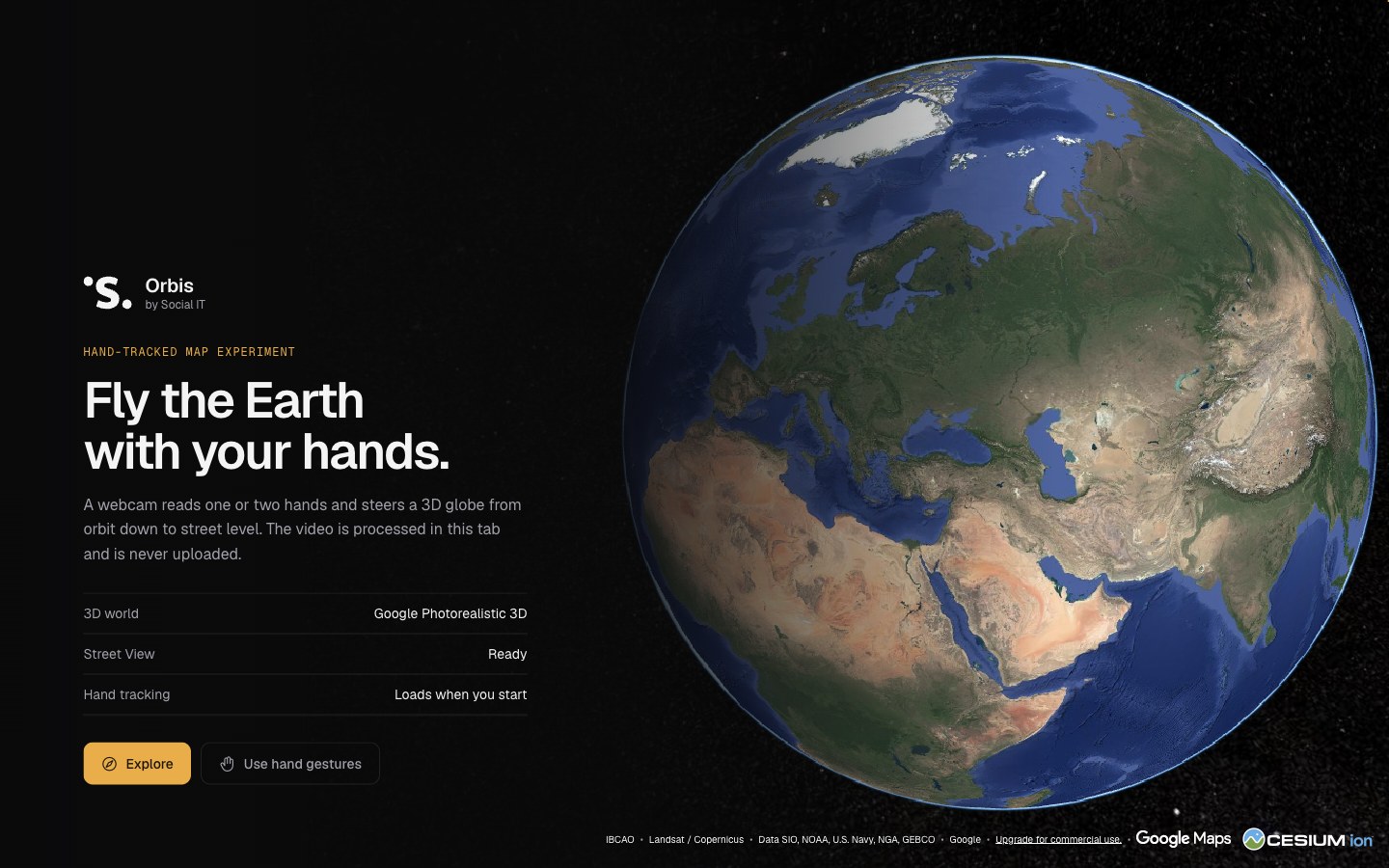
A 3D globe in the browser, with photorealistic cities and Street View. You explore it with the mouse, the keyboard or your hand, in front of the webcam. You can build guided tours on it, with questions.
- For
- Schools, museums and tourism
- What we did
- Research, design and development
- Status
- Beta, since November 2026
How it works.
The globe
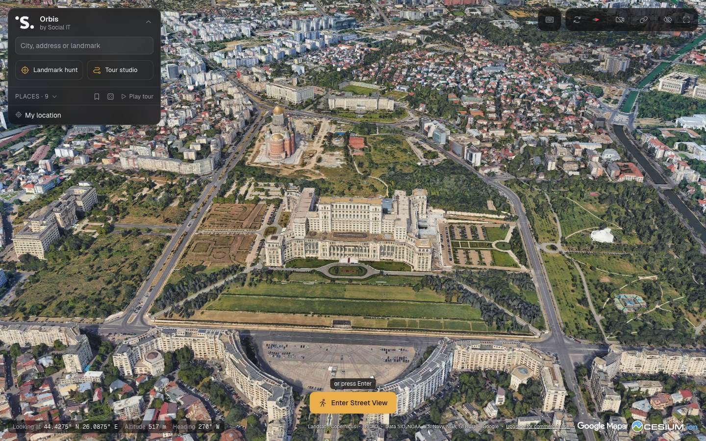
From orbit down to street level, with CesiumJS. The cities are photorealistic 3D models from Google.
Search
A city, an address or a landmark, by name. Any view can be sent as a link.
Street View
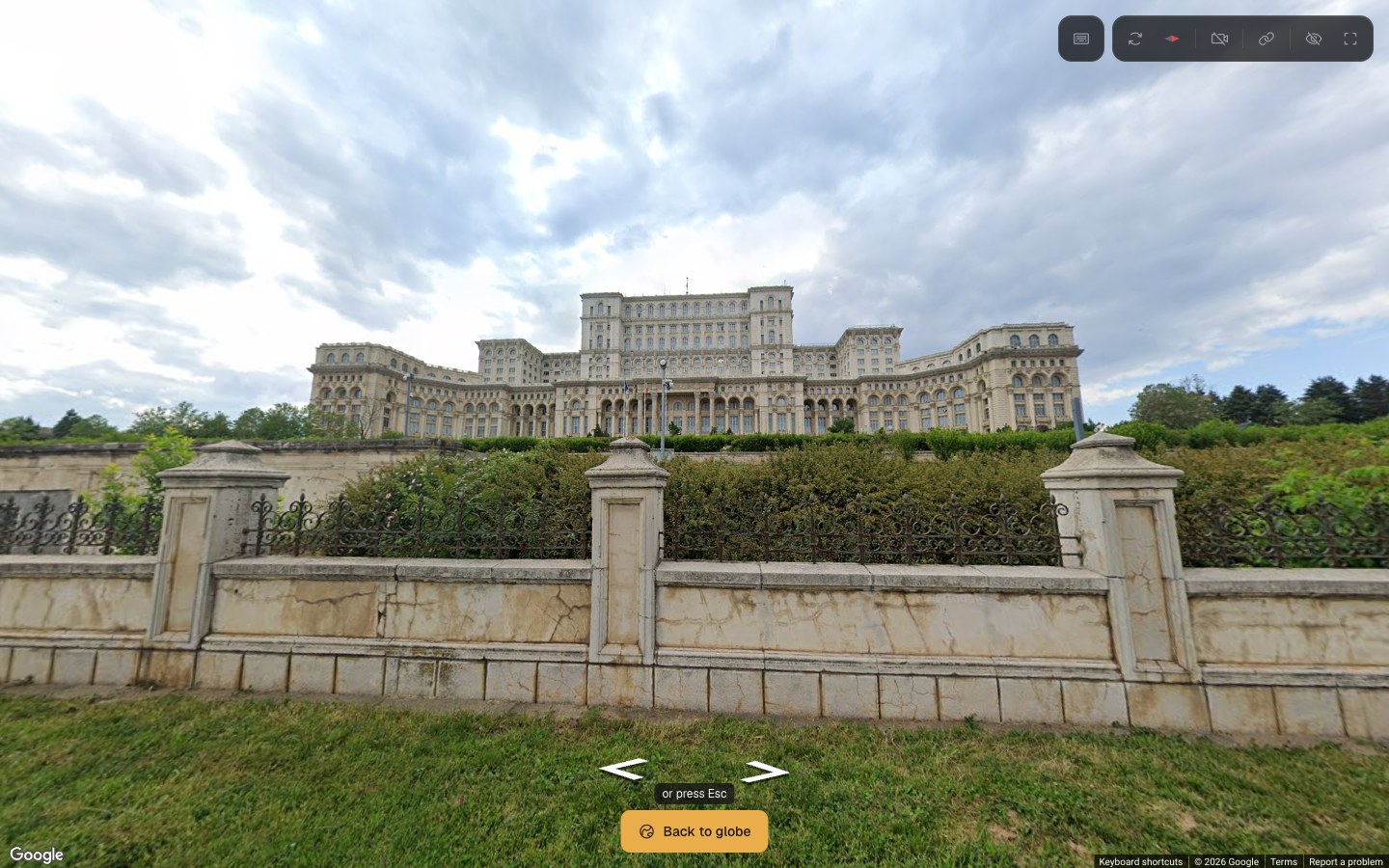
From any covered place you go down to the street and back to the globe.
Gestures
Optionally, the webcam follows your hands: a closed hand drags the map, two closed hands zoom, turn and tilt.
The game
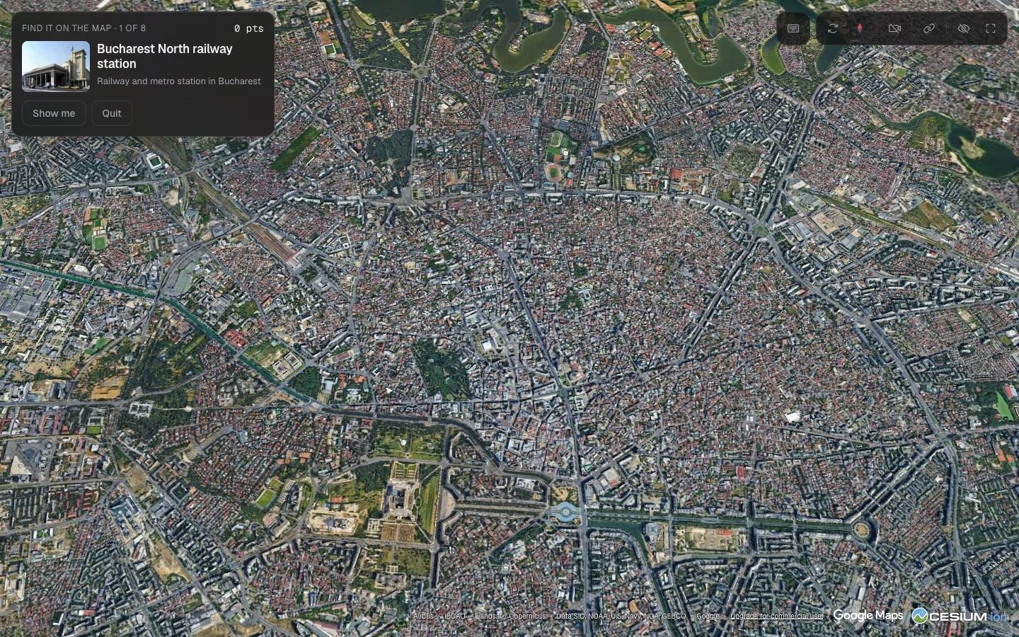
“Landmark hunt”: eight well-known buildings from the area on screen, taken from Wikipedia. You click where you think they are.
The tour
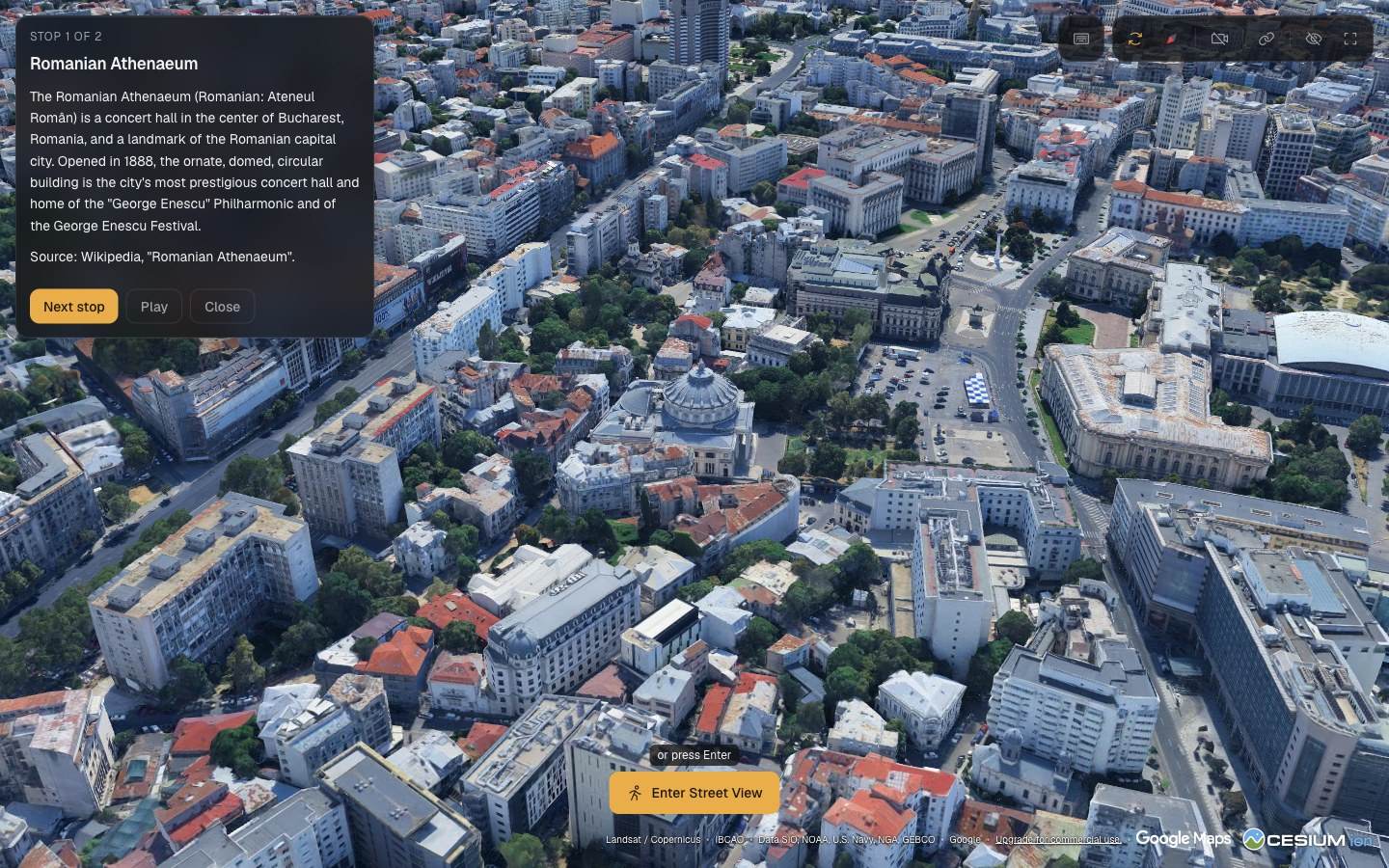
Stops with text and questions. At each stop the camera circles the landmark.
Tours and lessons.
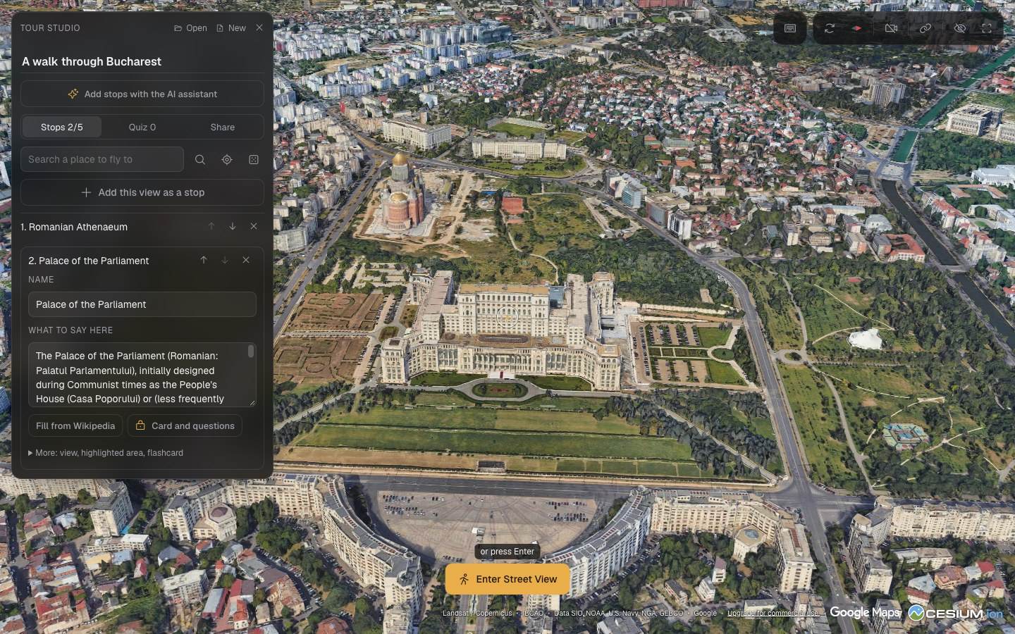
Tour studio
Stops are added from the map. Each has a name, a text and, if you want, a highlighted area and a flashcard.
Text from Wikipedia
One button brings in the first sentences of the place's article, with the source noted.
Quiz
Questions with three answers and questions of the “find the stop on the map” kind.
AI assistant
From one sentence, a Claude model proposes a tour of up to 5 stops, with flashcards and a quiz. A few tours a day are free.
Link or file
A tour of up to 5 stops is sent as a link or downloaded. No account.
For teachers
With a teacher passcode: tours of up to 20 stops, publishing with a short link and a live class.
The live class.
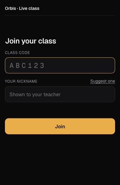
The teacher starts a class from Tour studio. Pupils join with a QR code or a six-character code and pick a nickname. They do not need an account.
In a teacher-led class, pupils see the text of the stop and the questions, and the map stays on the teacher's screen. The right answer appears only after the teacher shows it.
In a self-paced class, each pupil goes through the tour on their own map. The teacher can lock the maps, pause, or keep the whole class on the same step.
The teacher sees who has answered. Results by name are hidden by default, because the screen is usually projected, and are saved at the end as PDF or CSV. A class holds up to 40 pupils.
Technical decisions.
The 3D cities come through Cesium ion
Direct requests to Google for the 3D models are refused for accounts in the European Economic Area. We receive them through Cesium ion.
Coordinates never come from the model
The AI assistant only picks the places. The page looks them up on the map, takes the text from Wikipedia and checks, by coordinates, that the article is about that place. The model then writes only from these sources.
A short tour lives in its link
Up to 5 stops, the tour is packed into the address and needs no server.
A check before publishing
A tour goes through a word list, then is read by a model. If the check cannot run, the tour is not published.
No labels in the game
In the game the map shows no place names, and the street names in Street View are hidden.
Adaptive quality
When the frame rate drops, the page lowers the resolution and the detail of the map.
What stays private.
The camera image stays in the browser
Hand tracking, with MediaPipe Hands, runs in the page. The image is not uploaded anywhere.
Pupils have no account
They join with a nickname. Nicknames and answers stay on the server for as long as the class lasts and are deleted when the teacher ends it.
What reaches others
Google and Cesium receive the map requests, Wikipedia the names and coordinates of the places, and Anthropic the request for the AI assistant.
Status.
Orbis is not launched. Since November 2026 it can be tried as a beta, on a computer; we have not tried it on phones yet. The interface is in English. Publishing tours and the live class are the newest parts and we are still trying them out.
Write to us.
Do you have a procedure that would run more easily in an app? Tell us in a few lines what you want to solve. You do not need a prepared document. We will then set up a first conversation.
contact@socialit.ro